
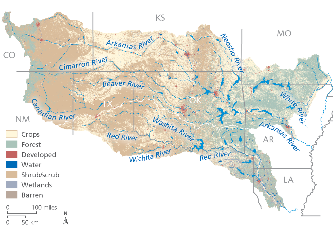
The Arkansas River Basin originates in the Rocky Mountains and empties into the Lower Mississippi River, covering a total length of 1,469 miles. It is the second longest tributary of the Mississippi River and is highly valued for its recreational uses including swimming, boating, fishing and hunting. Navigation on the lower portion of the river is maintained by a series of 18 locks and dams, which also enhance recreation, produce hydroelectric power and provide flood control.
The Red River Basin forms most of the Texas-Oklahoma border before emptying into the Mississippi River in Louisiana. Much of the management of the river, according to the Red River Compact, is based on the appropriation of water to agriculture, municipalities, industry, hydroelectric power and recreational uses while balancing ecosystem health needs.
The Arkansas and Red River Basin also faces additional challenges in water stress associated with potential transfers of water resources outside of the basin. A substantial portion of the basin is west of the 100th meridian that marks a shift in precipitation, with wetter conditions to the east of the 100th meridian. The very poor result for lock delays, combined with the very poor infrastructure condition and maintenance, are especially troubling considering that these locks and dams are newer than many other sections of the system having been completed in the early 1970s.
Related Links

Grades Explained by Goal
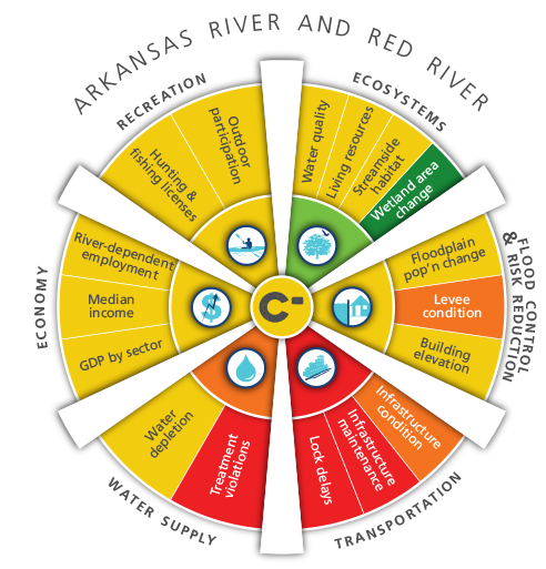
Ecosystems
The Arkansas River & Red River Basin received a grade of B for Ecosystems. The Living Resources indicator received a C. The Streamside Habitat indicator received a grade of C+ and the Water Quality indicator received a C- grade. The Wetland Area Change indicator received an A Grade, one of only two basins with this highest grade.
Flood Control & Risk Reduction
The Arkansas River & Red River Basin received a grade of C- for Flood Control & Risk Reduction. The Floodplain Population Change indicator in the Arkansas & Red River basin received a C grade and was the highest in the watershed. The Levee Condition indicator received a D grade and the Building Elevation indicator received a C- grade.
Transportation
The Arkansas River & Red River Basin received a Failing grade for Transportation. The Infrastructure Condition indicator received an F. The Infrastructure Maintenance indicator received an F for the entire watershed. The Lock Delays indicator received an F grade.
Water Supply
The Arkansas River & Red River Basin received a grade of D for Water Supply. The Treatment Violations indicator in the Arkansas River & Red River Basin received an F grade, one of two basins with this grade. The Water Depletion indicator received a C-grade.
Economy
The Arkansas River & Red River Basin received an overall grade of C for Economy. The River Dependent Employment indicator in the Arkansas & Red River basin received a C grade while the Median Income indicator received a C- grade. The GDP by sector indicator received a C grade.
Recreation
The Arkansas River & Red River Basin received a grade of C for Recreation. The Outdoor Participation indicator received a C- grade and the Hunting and Fishing licenses indicator received a C.